Freedom fighter, statesman and political thinker General Garegin Nzhdeh (1886-1955) was one of the pivotal figures in the Armenian quest for an independent Armenian nation and a revolutionary leader in Armenia, Bulgaria and Russia.


Freedom fighter, statesman and political thinker General Garegin Nzhdeh (1886-1955) was one of the pivotal figures in the Armenian quest for an independent Armenian nation and a revolutionary leader in Armenia, Bulgaria and Russia.
BY ALISA GEVORGYAN
Source: Armenian Public Radio
Findings at archaeological site in Armenia could shed light on a number of questions
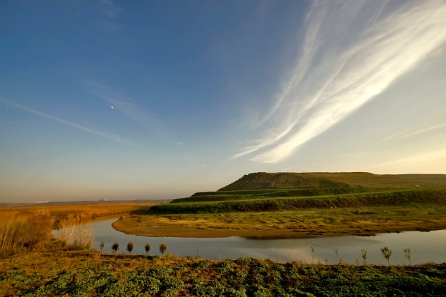
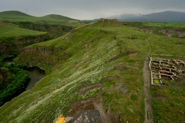
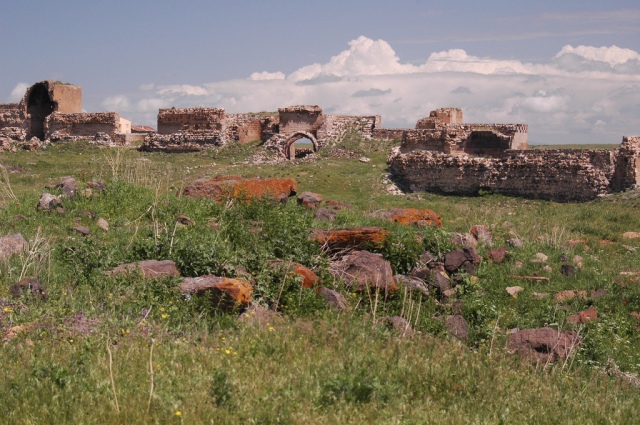
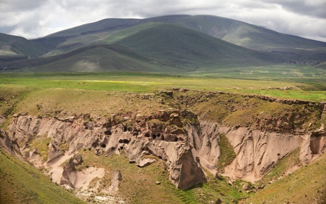
YEREVAN—A massive cemetery found as a result of three years of archaeological excavations in the ancient site of Karmir Blur (Red Hill) in Yerevan is of huge scientific significance, says Hakob Simonyan, head of the expedition and Director of the Historical Cultural Heritage research center of the Ministry of Culture. According to him, the archaeological materials found at the site could give an answer to a number of questions about the residents of the area, their perceptions of the afterlife and their burial rituals.
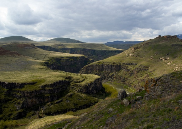
Karmir Blur or Teishebaini, which is presently located near the city of Yerevan, was a provincial capital of the 9th to 6th century B.C. Kingdom of Van (better known as Urartu).
Hakob Simonyan says the Kingdom of Van has always been in the spotlight of scientists. However, no graveyard had ever been found on the huge territory until the decision was made to construct a highway bypassing Yerevan, which could only pass through Karmir Blur.
As a result of three months of research, scholars have found densely located tombs. There are 500 tombs just under the road being constructed.
The kings of Van viewed the Ararat Valley as a granary, where the finest wines were produced. Hakob Simonyan says half a million liters of wine was kept in the pantries of Karmir Blur. Huge reserves of grain were also kept in the city.
Among the most important items found at the site were the “four idols” – tuff tiles with holes in the shape of eyes. Scientists assume the idols protected the peace of the dead. It’s now unclear whether the people buried in the cemetery were from the same family, nationality or represented completely different ethnic groups. The answer to this question will become clear after a DNA test. Samples have already been sent to Copenhagen.
According to Hakob Simonyan, Karmir Blur contains exceptional archaeological material, which could give answers to a number of questions. He says as many as 5,000 artifacts could be found at the site. Where they will be kept is a different question. Scholars are confident that it’s high time for Armenia – a country with a powerful cultural heritage – to have Anthropological and Urartian Centers.
As for the excavations at Karmir Blur, Hakob Simonyan says both the Eurasian Bank and Yerevan City Hall have promised that no historic monument will be destroyed and the road will be constructed only after the area is fully investigated.
9th century BC. Urartu burial in Karmir Blur Armenia
In order to redirect traffic from the loaded roads of Armenia’s capitol, officials in Yerevan commissioned a construction of a highway near the territory of Karmir Blur. Before the construction could commence, experts were tasked to investigate the area and carry out several excavations. When in August archaeologists started to investigate the site, they discovered that Charbahe cemetery and the surrounding areas once served as a burial place during the Urartu period in the 9th century BC.
Nowadays the kingdom of Van that was known to the Babylonians as Urartu, is attracting attention from European, American, Russian, Iranian and Turkish scientists. Urartu is mentioned several times in the Bible as Ararat. On one occasion it is described as the country of Noah’s descend after the deluge. In the trilingual Behistun inscription, carved in 521 BC by the order of Darius the Great of Persia, the country referred to as Urartu in Assyrian is called Arminiya in Old Persian and Harminuia in Elamite. Armenia, Urartu, Ararat and Herminuia are therefore synonymous.
Archaeologists leading the excavation discovered in recent months around 500 tombs, each containing at least 2 individuals. Some of which belonged to the upper class of the Ararat kingdom. During these excavations about 1,000 items were recovered, with many more yet to be extracted. These artifacts together with the human remains will help to reveal many secrets of the ancient Armenian kingdom.
The tombs resemble chambers, filled with earth, and the top covered with huge boulders plastered with lime. The knees of the discovered skeletons are bent, females lie on the left side while males on the right side. Buried with them were also servants, whose bones were divided into several parts. Aside the buried, idols were placed made of tuff tiles with holes in the shape of eyes. They were supposed to protect their owners from evil spirits in the afterlife. Among the finds, archaeologists recovered the skeleton of a very tall woman. She wore a chased belt and a copper bracelet on her ankle.
The researches also found a cellar and a horse stable. Barns were filled with large stocks of grain and a huge area which indicates that more than half a million liters of wine was kept there. Yet another section of the tombs, probably belonged to the workers of the ancient city.
The first stage of excavations is finished. The results have already sparked the interest of foreign scientists. Hermitage director Mikhail Piotrovsky was in Yerevan during the excavation and could not hide his excitement and amazement of the findings.
These sensational discoveries have also sparked several questions in regards to where the artifacts, numbers of which exceeds five thousand, should be kept and where they should be displayed. Some have suggested that it is high time for Armenia to create Anthropological and Urartian Centers of their own.
These new findings will be a vital source of information on the origins, genetics and ethnicity of the people of kingdom of Van. From previous excavations of Karmir Blur we know to what civilization and culture citizens of Teishebaini belonged. These excavations will also provide comprehensive information about the funeral rites and the ancient´s representation of the afterlife.
It is worthy to note that previously no anthropological studies have been conducted in regards to the population of Kingdom of Van. Due to the large amount of discovered artifacts scientists are now able to formulate serious conclusions. Some samples from the graves are already sent to Copenhagen for DNA research. The analysis will shed light on ancient Armenian ethnos.
To be able to conduct such research domestically Armenian scientists consider it also necessary to create an anthropological laboratory in their own country. After all, Armenia is the heir of a huge archaeological, historical and cultural heritage. Secrets of which are gradually coming to light.
Images from the burial:


Source: http://imyerevan.com/ru/society/view/5117
Bellow the text that was used in the video including parts that didn’t made it into the video and a selection of maps of terrestrial Paradise:
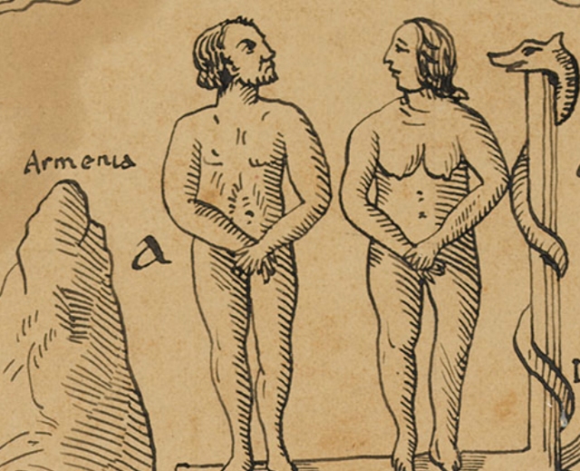
The Biblical account of the garden of Eden has for long preoccupied the minds and imaginations of theologians, believers and countless adventurers of the past. Many have attempted to identify the location of the garden and put forward theories ranging from the underground, the north pole and even the surface of the moon. However if the location of the terrestrial paradise is to be understood according to scriptures, there is only one place that fits the description. That place is historic Armenia.
The Bible mentions a spring in the Garden which parts into four major rivers, including Tigris and the Euphrates. Tigris and Euphrates both have their headwaters in the area surrounding Mt. Ararat in historic Armenia. Many Biblical scholars have therefore placed the garden of Eden in Armenia. They have argued that posterity of Seth and Noah’s ark have remained close to Eden. Thus the birthplace of mankind is also the place of rebirth. These accounts are supported by ancient believes of the people of Mesopotamia, who often considered the Armenian Highlands to be the dwellings of the Gods (Cyclopædia of Biblical, Theological, and Ecclesiastical Literature, 1894).
In his memoirs Lord Byron writes:
“If the Scriptures are rightly understood, it was in Armenia that Paradise was placed. – Armenia, which has paid as dearly as the descendants of Adam for that fleeting participation of its soil in the happiness of him who was created from its dust. It was in Armenia that the flood first abated, and the dove alighted. But with the disappearance of Paradise itself may be dated almost the unhappiness of the country ; for though long a powerful kingdom, it was scarcely ever an independent one, and the satraps of Persia and the pachas of Turkey have alike desolated the region where God created man in his own image.” – Armenian exercises and poetry, 1886
That Armenia was once considered the location of terrestrial Paradise can be attested from old maps and theological records. See blow for the maps.
Alessandro Scafi (2007) in his work “Finishing the unfinished: Paradise in Fausto da Longiano’s vernacular translation of Piccolomini’s Cosmographia (1544), describes Fausto and his thoughts on the location of terrestrial Eden. He writes:
“As a possible location, Fausto (1544) proposed Armenia, a region which in the sixteenth century included the area between the upper Euphrates and Lake Urmia, the Black Sea and the Syrian desert. The identity of two of the four rivers named in Genesis, the Tigris and the Euphrates, was uncontroversial, and both rivers were known to rise in Armenia. The more problematic Gihon and Pishon could be identified amongst the local rivers (for Fausto, the Araxes and the Cyrus).”
Joseph E. Duncan (1972) likewise recounts:
“Both Pererius and Lapide had suggested Armenia as logical location for Eden and paradise. Johann Vorstius, maintaining that Scripture clearly stated that the great river arose in Eden itself, also contended that Eden and paradise must be in Armenia.
One of the most complete of the earlier arguments for an Armenian paradise was offered by Carver in a tract publication in 1666… He found the site of Eden in Armenia Major, on the south side of Mount Taurus. He speculated that paradise might have been transformed into a nitrous lake which Pliny had said was located in this area.”
17th century French scholar Joseph Pitton de Tournefort writes:
“And if we may suppose the Terrestrial Paradise to have been a place of considerable extent, and to have retained some of its beauties, notwithstanding the alterations made in the Earth at the Flood, and since that time; I don’t know a finer spot to which to assign this wonderful place, than the Country of the Three-Churches (Echmiadzin-Armenia), about twenty French leagues distant from the Heads of Euphrates and Araxes, and near as many from the Phasis.” – A Voyage Into the Levant (1741)
In their Encyclopedia of Biblical, Theological, and Ecclesiastical literature (1894), John McClintock and James Strong recount nine principal theories of the proposed location of earthly paradise. Armenia is considered the most likely location of Eden.
“The opinion which fixes Eden in Armenia we have placed first, because it is that which has obtained most general support, and seems nearest the truth. (See No. vi.) For if we may suppose that, while Cain moved to the East (Gen. iv, IG), the posterity of Seth remained in the neighborhood of the primeval seat of mankind, and that Noah’s ark rested not very far from the place of his former abode, then Mount Ararat in Armenia becomes a connecting point between the antediluvian and post-diluvian worlds (Gen. viii, 4)”
Eden is shortly described as follows:
“Eden was a tract of country, and that in the most eligible part of it was the Paradise, the garden of all delights, in which the Creator was pleased to place his new and pre-eminent creature, with the inferior beings for his sustenance and solace.”
“As nearly as we can gather from the Scriptural description, Eden was a tract of country, the finest imaginable, laying probably between the 35th and the 40th degree of N. latitude, of such moderate elevation, and 80 adjusted, with respect to mountain ranges, and watersheds, and forests, as to preserve the most agreeable and salubrious conditions of temperature and all atmospheric changes. Its surface must therefore have been constantly diversified by hill and plain. In the finest part of this land of Eden, the Creator had formed an enclosure, probably by rocks, and forests, and rivers, and had filled it with every product of nature conducive to use and happiness. Due moisture, of both the ground and the air, was preserved by the streamlets from the nearest hills, and the rivulets from the more distant; and such streamlets and rivulets, collected according to the levels of the surrounding country (“it proceeded from Eden”) flowed off afterwards in four larger streams, each of which thus became the source of a great river.
Here, then, in the south of Armenia, after the explication we have given, it may seem the most suitable to look for the object of our exploration, the site of Paradise.”
That the Biblical rivers cannot be identified with Nile (as some would claim) is described as follows:
“That the Hiddekel (this name is said to be still in use among the tribes who live upon its banks—Col.Chesney, Erp. to Tigris and Euphrates, i, 13) is the Tigris, and the Phrath the Euphrates, has never been denied, except by those who assume that the whole narrative is a myth which originated elsewhere, and was adapted by the Hebrews to their own geographical notions. As the former is the name of the great river by which Daniel sat (Dan. x, 4), and the latter is the term uniformly applied to the Euphrates in the Old Testament, there seems no reason to suppose that the appellations in Gen. ii, 14 are to be understood in any other than the ordinary sense. One circumstance in the description is worthy of observation. Of the four rivers, one, the Euphrates, is mentioned by name only, as if that were sufficient to identify it. The other three are defined according to their geographical positions, and it is fair to conclude that they were therefore rivers with which the Hebrews were less intimately acquainted. If this be the case, it is scarcely possible to imagine that the Gihon, or, as some say, the Pison, is the Nile, for that must have been even more familiar to the Israelites than the Euphrates, and have stood as little in need of a definition.”
That Eden is described in a post-deluvian manner as opposed to the Lutherian idea of geography being altered due to the flood is explained as follows:
“Nor will it do to suppose that in former ages great changes had taken place, which have so disguised the rivers in question that their course, connection, and identity are not now traceable ; for two of the rivers, at least, remain to this day essentially the same as in all historic times, and the whole narrative of Moses is evidently adapted to the geography as it existed in his own day, being constantly couched in the present tense, and in terms of well-known reference as landmarks.
Luther, rejecting the forced interpretations on which the theories of his time were based, gave it as his opinion that the garden remained under the guardianship of angels till the time of the Deluge, and that its site was known to the descendants of Adam ; but that by the flood all traces of it were obliterated. But, as before remarked, the narrative is so worded as to convey the idea that the countries and rivers spoken of were still existing in the time of the historian. It has been suggested that the description of the garden of Eden is part of an inspired antediluvian document (Morren, Rosenmiiller’s Geogr. i, 92). The conjecture is beyond criticism ; it is equally incapable of proof or disproof, and has not much probability to recommend it. The effects of the flood in changing the face of countries, and altering the relations of land and water, are too little known at present to allow any inferences to be drawn from them.”
In his memoirs “Armenia, travels and studies” famous Brit H. F. B. Lynch writes:
“What attracted me to Armenia? One inducement was curiosity : what lay beyond those mountains, drawn in a wide half-circle along the margin of the Mesopotamian plains? The sources of the great rivers which carried me southwards, a lake with the dimensions of an inland sea, the mountain of the Ark, the fabled seat of Paradise.”
During her travels in Armenia, missionary Maria A. West wrote:
“This is the Christian Crusade of the nineteenth century ; far exceeding in moral sublimity that of the olden time, when the kings of the earth banded themselves together to rescue the Holy Land from the hand of the Turk ! How wonderful that the Great Commission, the Master s last Command, uttered in this very land, more than eighteen hundred years ago, should have been caught up, and re-echoed in the New World, by a nation not yet a century old ! That scores of its sons and daughters should carry the “ glad tidings” from the Caspian and Black Seas on the north, beyond the Mediterranean on the south : In the country of Eden, and Ararat, the cradle of the human race.”
“A lovely lake, like that of Galilee, sleeps within their embrace; a branch of the Euphrates curves its gleaming arm around this wondrous mosaic of emerald and agate, carnelian and onyx, with the golden sunlight resting upon embowered villages, of which we count twenty-five without, and fifty with the aid of a glass, their beaten paths crossing and recrossing the plain, in every direction.
It may indeed have been, as the people say, “the very Garden of Eden” where Adam and Eve together watched the opening of blushing flowers and the ripening of luscious fruits, after the marriage ceremony “ the crowning” as the Orientals call it had been performed ; for, “in the day that God created man male and female created He them, and BLESSED THEM, and CALLED THEIR NAME ADAM.” Here, perhaps, they plucked and ate the forbidden fruit, whose prolific seeds have borne bitter harvest all over the face of the wide, wide world !”
And this lost Paradise, so long trodden under foot by the Destroyer, “her hedges broken down, so that all they which pass by the way do pluck her, wasted by the boar out of the wood, and devoured by the wild beast of the field:” -This vineyard, planted “eastward” -by God s “right hand” -at the opening of man’s history – (“a river went out to water it;” and from thence it was parted and became four heads ; and the fourth river is “Euphrates:”) -This long-deserted Garden is to be “regained” for the “second Adam,” and made to “blossom as the rose;” to “ blossom abundantly, and rejoice even with joy and singing ; the glory of Lebanon shall be given unto it, the excellency of Carmel and Sharon ; and the REDEEMED shall walk there.”
Our national birthday of freedom finds us on these distant heights in the land which was the cradle of the human race the land of Ararat, the country, if not the Garden of Eden, where we may suppose our first parents wandered after their expulsion from Paradise, and obtained their bread by the sweat of their brow. And we, their self-exiled children, are striving to undo the mischief which their disobedience brought on these fair plains, and among these smiling valleys and rugged mountains.
The Armenian language belongs to the Indo-Germanic family, enriched with many Sanscrit words, but having no affinity to the Semitic, or any of the more modern tongues. The people claim that it was the language of paradise, and will be the language of the heavenly world.
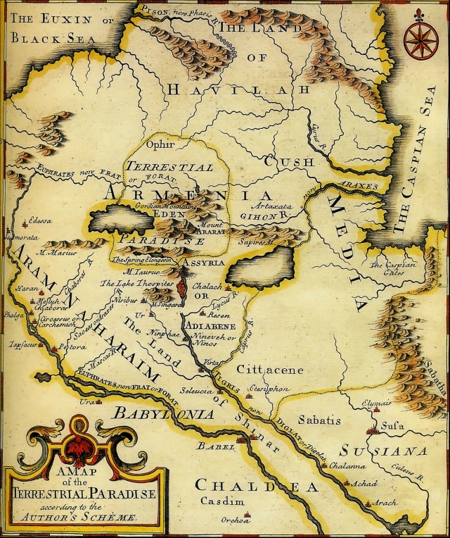
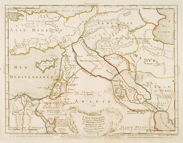
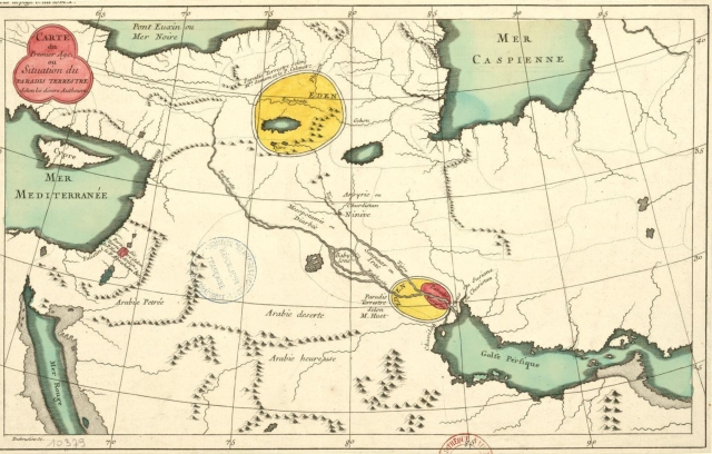
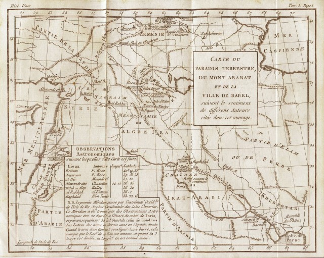
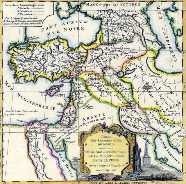
Selection of antique maps of terrestrial Paradise:
A Map of the Terrestrial Paradise, Emmanuel Bowwen (1780)
Fine map of the Middle East, including the Holy Land, Cyprus, Iran and Irak, etc.
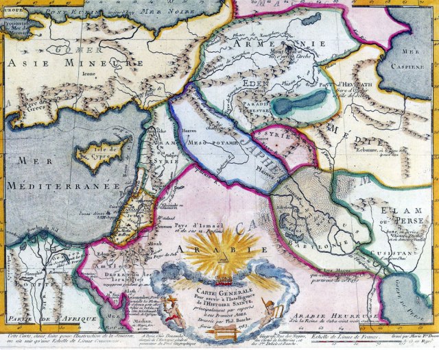
Philippe Buache was one of the most active proponents of the so-called “school of theoretical cartography” active in mid-18th century France. Published by Dezauche and engraved by Marie F. Duval.
Paradis Terrestre by Desbrulins, F. 1700-1799 source Bibliothèque nationale de France
Eden in Armenia 8th century world map from Turin
Eden in Armenia 8th century world map from Turin
A General Map for Information about the History of the Saints, Phillippe Buache, Published in 1783 in Paris.
Map of the Earthly Paradise by Moyse, 1724 Source: Bibliothèque nationale de France
Map of the Earthly Paradise by Moyse, 1724 Source: Bibliothèque nationale de France
Antique map of the Paradise, Huet Stark-man, 1725 ‘Kaarte van Het Aardsche Paradys’
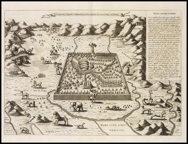
Athanasius Kircher, 1675 Topographia Paradisi terrestris juxta mentem et conjecturas
L’Arménie, jardin d’Eden, page de l’Atlas de cartographie historique de l’Arménie, Jacques Khanzadian, copie de carte ancienne, 1675
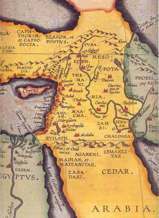
Map from the atlas Theatre of the World by Abraham Ortelius featuring Eden in Armenia. Antwerp, 1601
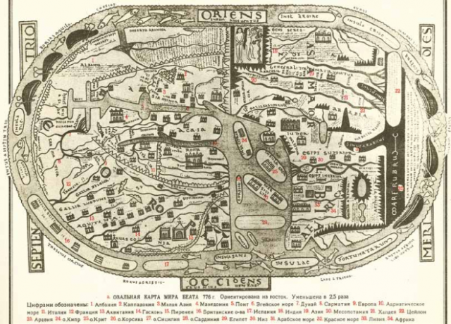
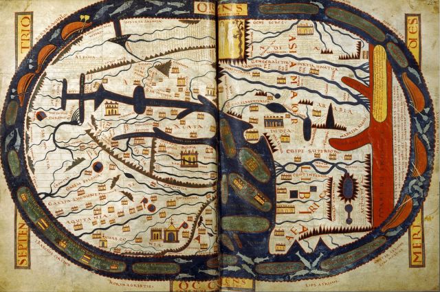
Овальная карта мира Беата (776 г.) из «Атласа истории географических открытий и исследований». Москва, 1959
Увеличенный фрагмент той же карты, с подписью «Armenia regio».
The Manchester (a.k.a. Altamira) Beatus mappamundi, ca. 1175,
The Manchester (a.k.a. Altamira) Beatus mappamundi, ca. 1175, John Rylands Library, MS. Lat. 8, fols. 43v-44, Manchester, England
The world map from the Saint-Sever Beatus painted c. 1050 A.D. as an illustration to Beatus’s work at the Abbey of Saint-Sever in Aquitaine
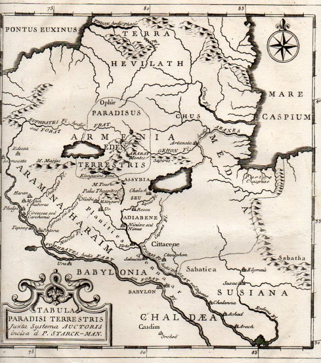
Carte Du Paradis Terrestre Suivant le Systeme de l Auteur et Execute par P. Starck-man
The map Tabula Paradisi Terrestris justa Systema Auctoris incisa a P. Stark-Man was printed late in the 18th century, probably around 1775.
Topographia Paradisi terrestris juxta mentem et conjecturas authoris, Kircher, Athanasius 1675
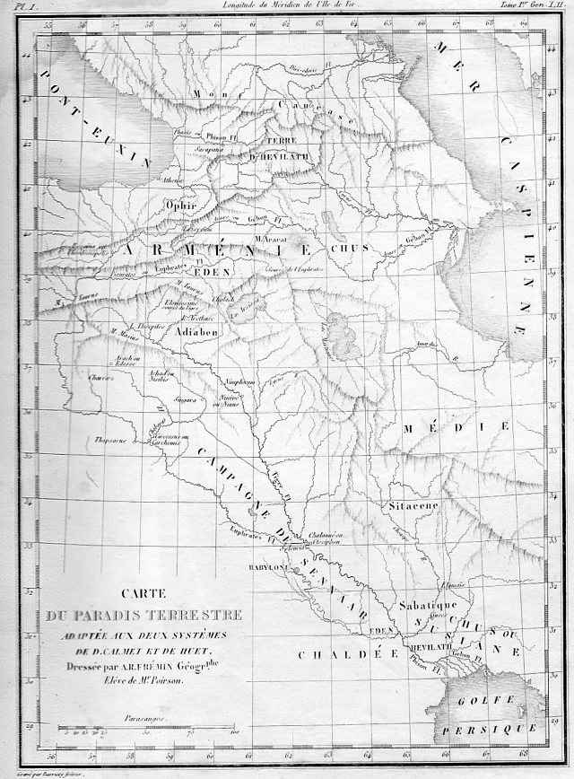
Antique map of the Garden of Eden by Calmet – 1789
Moxon’s Paradise of the Garden of Eden with the Countries circumjacent inhabited by the Patriarchs, printed in 1690
The Terrestrial Paradise (c.1780) by Louis Brion de la Tour from the ‘Histoire Universelle depuis le Commencement du Monde’
Ecclesiastical map of the first ages of the world, by S. Robert Vangondy 1762
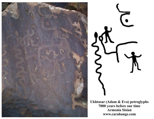
Ancient Armenian drawing of what resembles the story of Adam and Eve.

Print of Armenian Monastery at Venice in Italy 1838
View of Pera the Armenian quarter of Constantinople Istanbul 1838 print.
Print of Armenian emigrants in Russia 1838
Print of Armenian College of Moscow 1838
Print of Armenian present to King of Odesa 1838
Print of Armenian ladies 1838
Print of Armenian Saints 1838
Print of Armenian Saints 1838
Print of Armenian Saints 1838
Print of Armenian Saints 1838
Print of Armenian men 1838
Print of Armenian nuns 1838
Print of Armenian man 1838
Armenian lady at Constantinople, William Page 1823
Wealthy Armenian by Louis Dupre (1789-1837)
An Armenian Woman by William Page ca. 1816-1824
Armenian Ladies (At Home) by Van-Lennep, Henry John, 1815-1889
Armenian Piper by Van-Lennep, Henry John, 1815-1889
Armenian Lady (At Home) by Van-Lennep, Henry John, 1815-1889
Armenian Girl ca. 1850
Armenians ca. 1850
Kean, Edmund 18th c. Armenian man
Armenian prince and his wife by Louis Dupré 1825
Jeunes Filles Arméniennes by Camille Rogier 1846
Armenian lady from Yerevan by Gagarin 1842
Woman in Armenian marriage dress, from a volume entitled ‘Raccolta di 120 Stampe, che rappresentano, Figure, ed Abiti di varie Nazione’ by Viero 1783-90
Boghos Yusufian Bey 1845-1850 The devoted Minister & Confidential Adviser of the Renowned Mohamed Ali Viceroy of Egypt from 1817 to 1845
Governor of the Lebanon-Garabed Artin Davoud Oghlou 1843 by Vigne, Godfrey Thomas
Armenian man by Louis Dupré 1825
Ancient Armenian Church at Varzahan by Frederick Cooper 1849
Armenian Marriage Procession by Van-Lennep, Henry J. (Henry John), 1815-1889
Armenian Bride by Van-Lennep, Henry J. (Henry John), 1815-1889
Armenian Peasant Woman by Van-Lennep, Henry J. (Henry John), 1815-1889
Armenian ladies from Trabzon, Italian magazine
Armenian merchant, engraving from The navigations, peregrinations and voyages made into Turkie, by Nicolas de Nicolay (1517-1583), folio 154, 1568, Middle East, 16th century
An Armenian of Persia Vanmour, Jean Baptiste (1671-1737)
A 1766 portrait of Rousseau wearing an Armenian costume by Allan Ramsay.
Jean-Jacques Rousseau (28 June 1712 – 2 July 1778) was a social philosopher, moralist, writer, and composer of the 18th-century. His political philosophy influenced the French Revolution as well as the overall development of modern political, sociological, and educational thought. His ‘Discourse on the Origin of Inequality’ and his ‘On the Social Contract’ are cornerstones in modern political and social thought.
Rousseau was a successful composer of music, who wrote seven operas as well as music in other forms, and made contributions to music as a theorist. During the period of the French Revolution, Rousseau was the most popular of the philosophes among members of the Jacobin Club. Rousseau was interred as a national hero in the Panthéon in Paris, in 1794, 16 years after his death.
This sympathetic portrait of Rousseau in Armenian costume was painted by the highly talented Scottish artist Allan Ramsay. He is wears the fur hat and fur trimmed jacket of his favorite Armenian costume. This attire had aroused the great curiosity of London society following Rousseau’s arrival in Britain in 1766. Ramsay painted this portrait as a gift for his close friend David Hume, Rousseau’s host in London.
” The Armenian plateau stands equidistant from the Euxine and the Caspianseas on the north, and between the Persian Gulf and the Mediterranean on the south. “With the first it is connected by the Acampsis, with the second by the Araxes, with the third by the Tigris and Euphrates, the latter of which also serves as an outlet toward the countries on the Mediterranean coast.
Viewed with reference to the dispersion of the nations, Armenia is the true center of the world; and it is a significant fact that at the present day Ararat is the great boundary-stone between the empires of Russia, Turkey, and Persia. “
– Cyclopædia of Biblical, Theological, and Ecclesiastical Literature (1894)
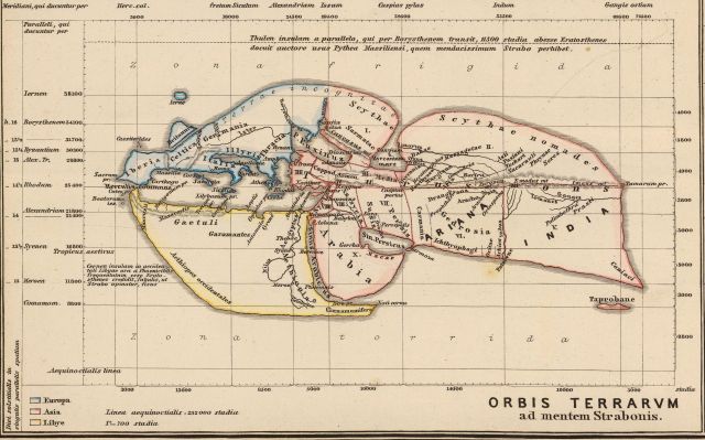
see maps bellow:
World according to Strabo (64/63 BC – c. AD 24)
Antique world map according to Herodotus (484–425 BC) by L. Fig, Hachette, 1884
Map according to Eratosthenes 276 – 194 BC., reproduced by A. Villemin in Earth and seas, or physical description of the world L. Figuier, Paris, Librairie Hachette, 1884
This map of the world according to Posidonius 1st c. BCE
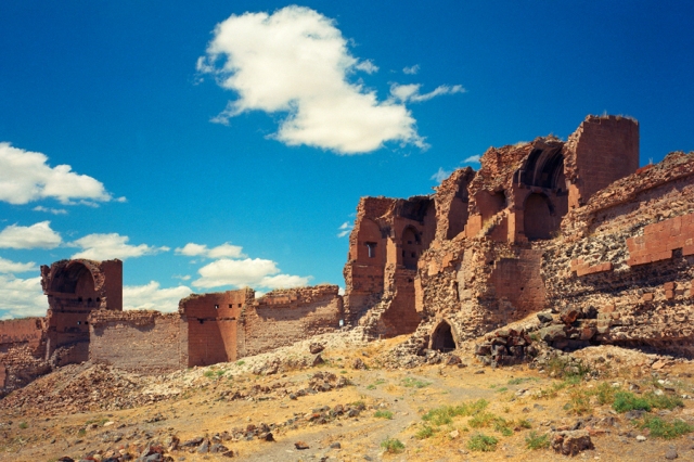
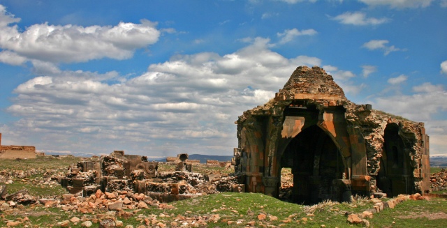
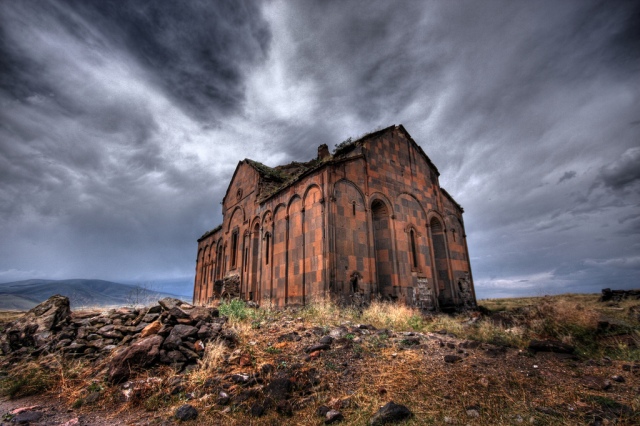
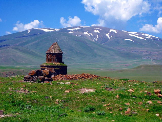
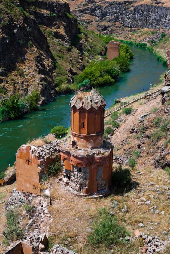
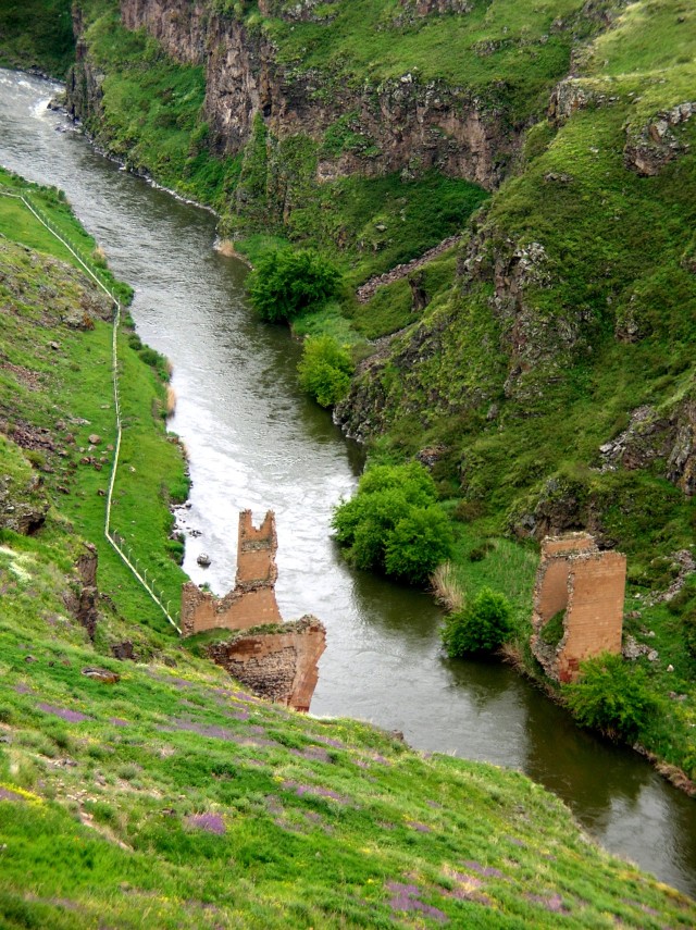
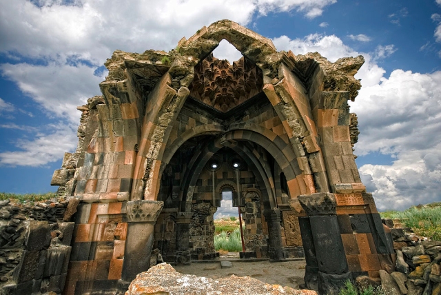
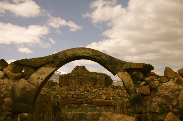
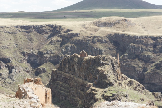
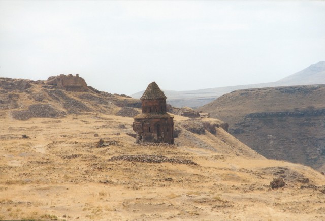
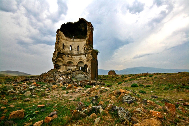
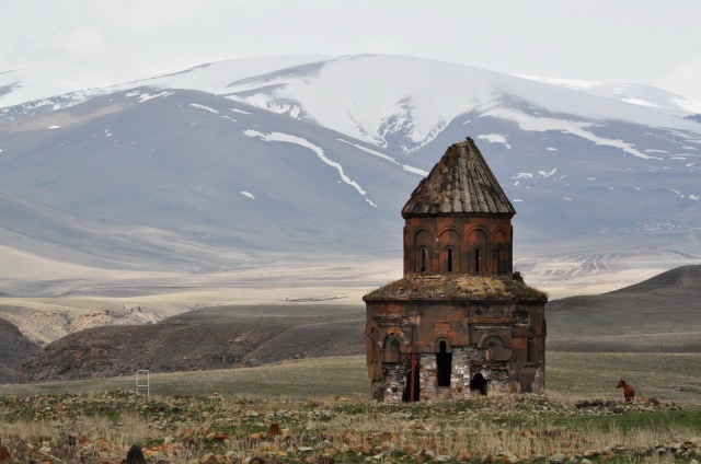
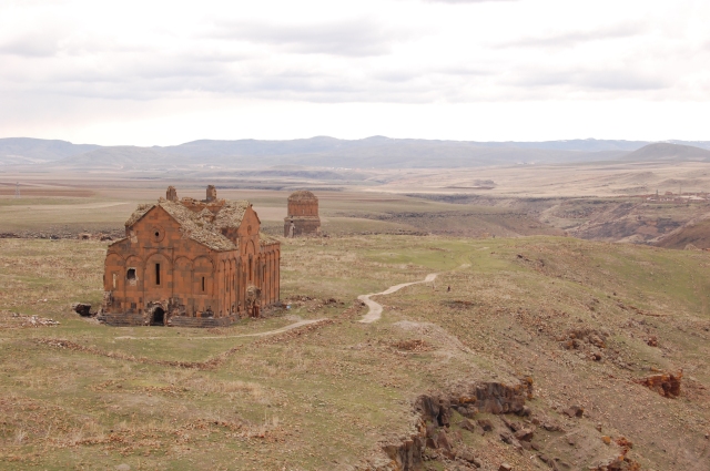
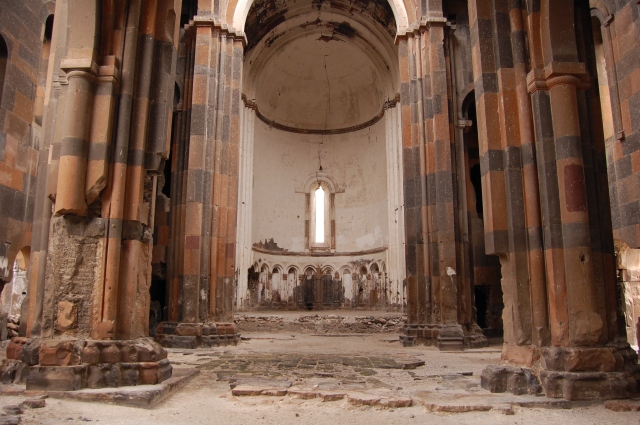
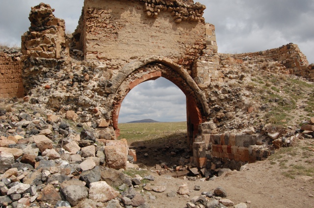
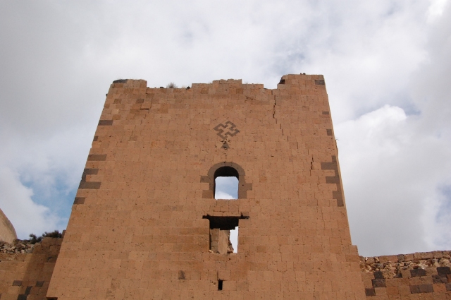
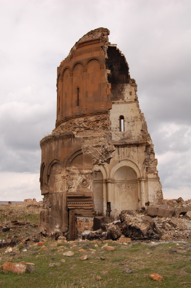
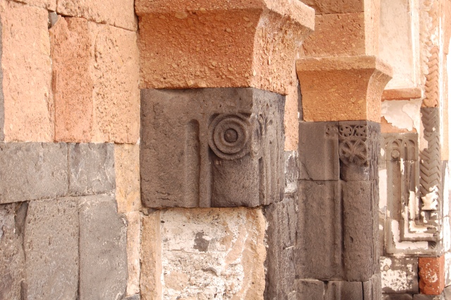
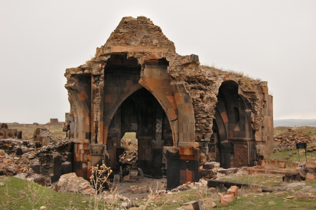
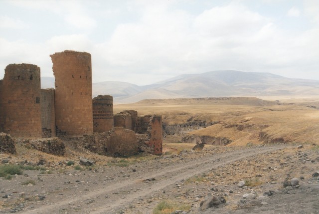
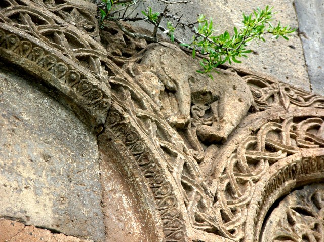
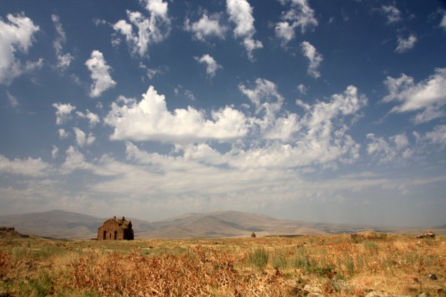
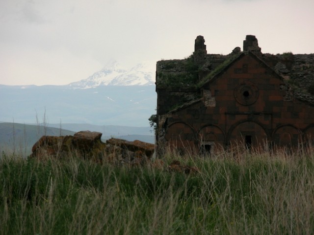
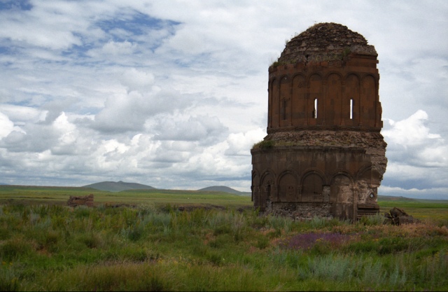
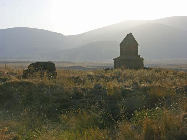
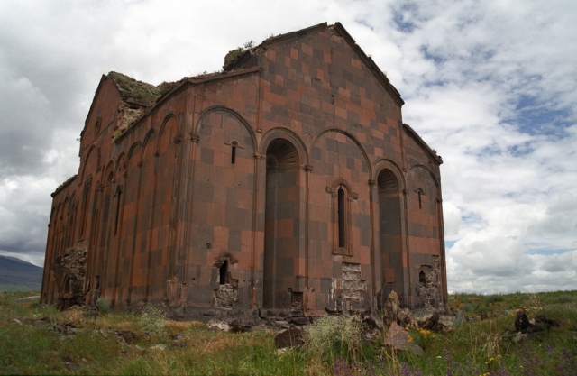
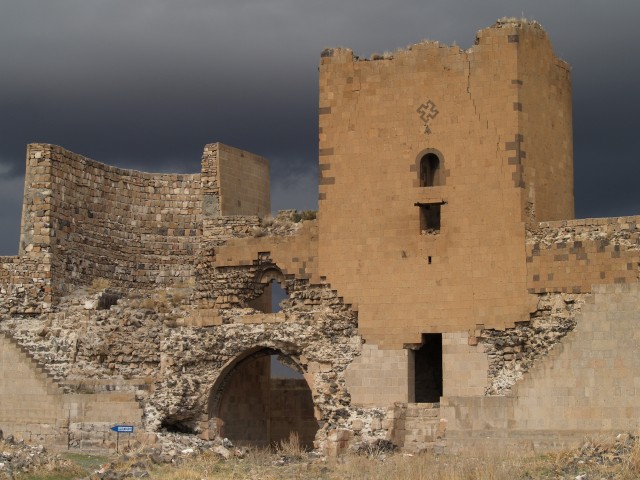
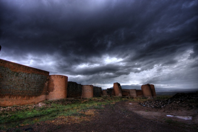
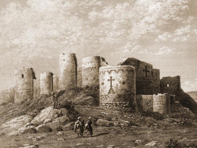
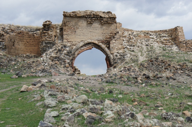
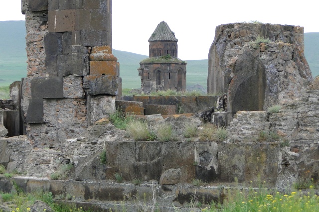
Some thousand years ago, the old Armenian capital Ani rivaled the likes of Constantinople, Baghdad and Cairo in size and influence. Historically Ani has been an Armenian settlement from the times immemorial. It is first mentioned in the 5th century Armenian chronicles as a strong castle built on a hilltop. Ani was made capital of the Bagratuni Kingdom in 961 AD. and by the 11th Century had grown to over one-hundred-thousand people. Renowned for its splendor and magnificence, Ani was known as “the city of 40 gates” and “the city of 1001 churches.” It would later become the battleground for various contending Empires, leading to its destruction and abandonment. Today Ani largely remains a forgotten ancient Armenian ghost town in modern day Turkey. Travelers, writers, and other adventurers through ages have described Ani with high regard. I think there is no better way to describe Ani but through the words of the people who have visited the site. Therefore bellow a selection of these heartwarming accounts.
Konstantin Paustovski a Russian Soviet writer, a Nobel prize nominee described Ani in 1923 with the following quotes:
“What is Ani like? There are things beyond description, no matter how hard you try.”
“On the other bank we saw basilicas, tiled Armenian domes and a complete absence of human beings. It was the ruins of the ancient Armenian capital, Ani – one of the real wonders of the world.”
The British member of parliament and businessman H. F. B. Lynch in 1893 also describes the city of Ani in his book “Armenia, travels and studies.”:
“But a lesson of wider import, transcending the sphere of the history of architecture, may be derived from a visit to the capital of the Bagratid dynasty, and from the study of the living evidence of a vanished civilization which is lavished upon the traveller within her walls. Her monuments throw a strong light upon the character of the Armenian people, and they bring into pronouncement important features of Armenian history. They leave no doubt that this people may be included in the small number of races who have shown themselves susceptible of the highest culture.”
“The roofs as well as the walls are composed of stone, and, as usual in Armenian churches, no wood or metal has been used. Even at the present day the Armenian masons are possessed of exceptional skill; and their natural gifts have been here directed by the conceptions of genius.
The merits of the style are the diversity of its resources, the elegance of the ornament in low relief, the perfect execution of every part.”
“We admire these buildings in much the same state and condition as when they delighted the eyes of Armenian monarchs nine centuries ago. Such a site would in Western lands be at least occupied by a small town or village; the solitude of Ani is not shared by creations of a culture that has disappeared.”
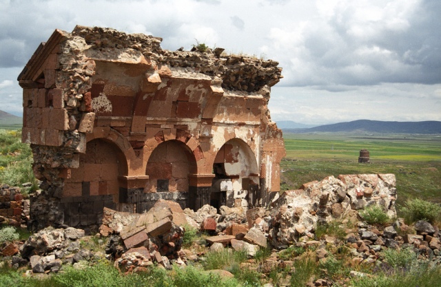
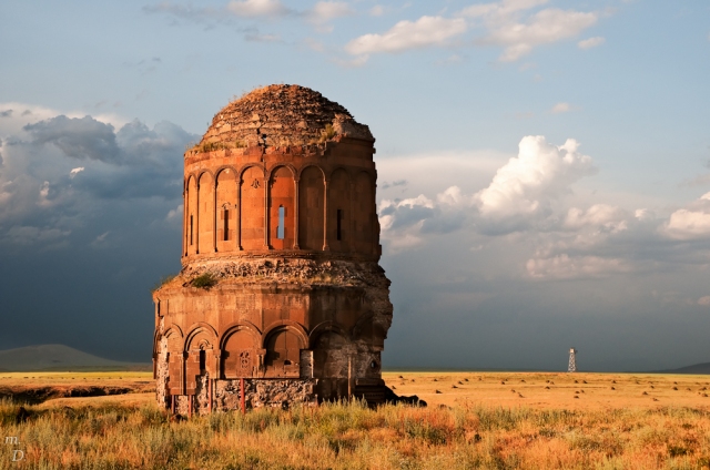
Church of the Redeemer, in Ani
An Italian historian, traveler and diplomat Luigi Villari in 1905 recounts Ani as follows:
“We walked over one or two brown ridges, and suddenly the walls of Ani came in sight. There they stood, massive piles of masonry extending for nearly a mile, with huge round towers at short intervals, mute testimony to the deeds of the Armenians in the brave days of old.”
“Nowhere, except at Constantinople, have I seen more splendid defences of a mediaeval city. For about two-thirds of a mile they are still standing, and broken fragments of them extend along the whole length of the circumference of the city and descend into the ravine of the Arpa Chai.”
“The marvelous city shows evidence of a building power and architectural skill on the part of the ancient Armenians of the highest order, and enables us to realize that this people, in spite of the lamentable history of the last six centuries, is a nation with a noble past.
Today this spot, where proud kings once dwelt in splendid courts and held sway over prosperous lands and civilized subjects, where public life was active and vigorous, is a crying wilderness. None but the old priest and the peasant family dwell within the enclosure, and even the neighbouring country, formerly so fertile and well-peopled, is now almost uninhabited, and has become to a great extent barren desert. Is the state of Ani symbolical of that of the Armenian nation, and are they destined at last to disappear or be absorbed into other races, other religions? I do not think so, for with all the sufferings and persecution they have undergone they still preserve a vigorous national life. Many of them have been massacred, but the survivors are not absorbed. Their industry is more active than ever, and education is making great progress. They have built up the oil trade of Baku, they monopolize the commerce of Tiflis, and at Rostoff-on-the-Don, Baku, Odessa, Moscow, Kishinieff, Constantinople, Bombay, Calcutta, and many another city far removed from their ancestral homes, they form industrious, intelligent, and prosperous commercial communities. A people with such a past and such a present need surely not despair of its future.”
Little did Villari know that only 10 years after these words Armenians would endure maybe the darkest of days in their entire history. The horrible events of the Armenian Genocide. Yet almost prophetic his words came true when Armenians overcame even these horrendous events and today there is still such a country (albeit smaller than its historic territory) that is called Armenia.
Sir E. A. Wallis Budge, London 1928. recounts the visit of of Nestorian Christian monks Sawma and Markos to Ani in the 1270s:
“And when they arrived at the city of Animto (Ani) and saw the monasteries and the churches therein, they marvelled at the great extent of the buildings and at their magnificence.”
Yet another highly memorable quote comes from an English artist, author, diplomat and traveller Sir Robert Ker Porter in 1817:
“In the western extremity of this great town, in which no living beings except ourselves seemed breathing, we saw the palace, once of the kings of Armenia; and it is a building worthy the fame of this old capital. Its length stretches nearly the whole breadth between the walls of the city on one side, and the ravine on the other. Indeed, it seems a town in itself; and so superbly decorated within and without, that no description can give an adequate idea of the variety and richness, of the highly wrought carvings on the stone, which are all over the building; or of the finely-executed mosaic patterns, which beautify the floors of its countless halls.”
“The farther I went, and the closer I examined the remains of this vast capital, the greater was my admiration of its firm and finished masonry. In short, the masterly workmanship of the capitals of pillars, the nice carvings of the intricate ornaments, and arabesque friezes, surpassed anything of the kind I had ever seen, whether abroad, or in the most celebrated cathedrals of England.”
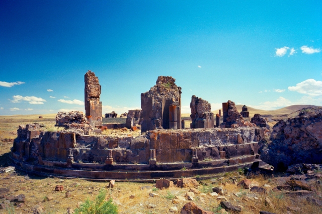
Church of the redeemer from about 1040 AD.
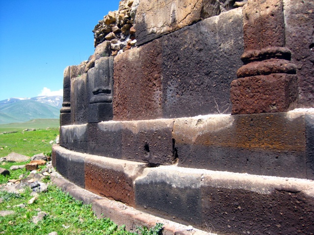
William J. Hamilton in 1836 too described the outstanding building techniques of the Armenian craftsman, being able to build structures that would last for centuries. He describes:
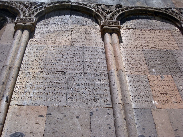
“There was something impressive and almost awful in the sight of a Christian town, built in a style so peculiar to itself, and unknown to modern Europe, now nearly in the same state in which its destroyers had left it eight centuries ago.”
“There is hardly a building in Anni of any consequence which is not covered with Armenian inscriptions.”
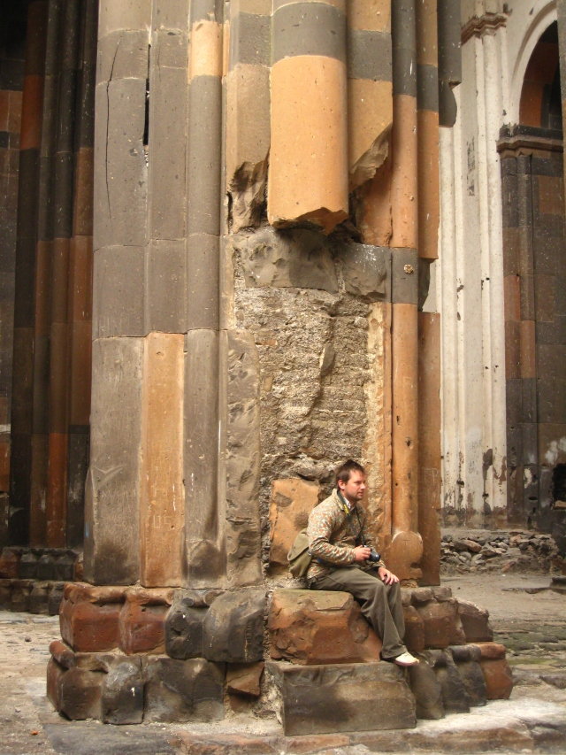
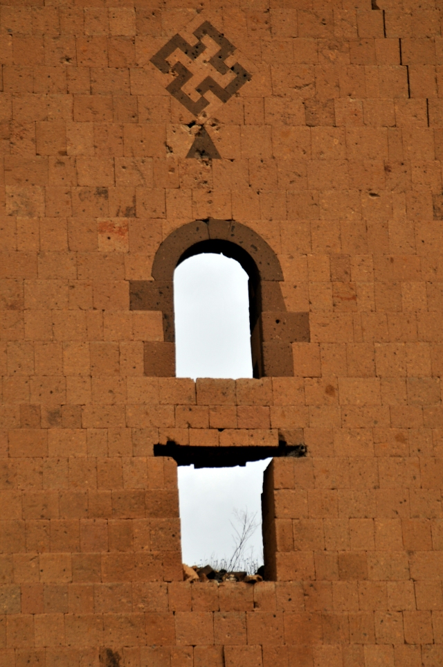
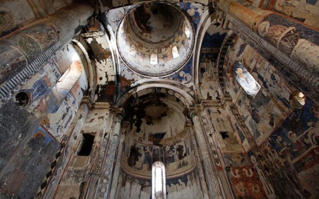
Church of Ani, st. Gregory of Tigran Honents
Foreign travelers are not the only once to have recorded Ani in such regard. Armenians who have visited the site of the ancient abandoned Armenian capital often had a hard time holding back their emotions. Basmadjian in 1903 describes the sites as follows:
“The traveler or the pilgrim, whether coming by horseback, by carriage, or even on foot, before arriving at this city in mourning, looks towards the site with a thousand thoughts. He is impatient; he strains to see it – even for just a moment – from afar, one doesn’t know if it is to feel an inner contentment or to satisfy the longings of many years. It is a powerful feeling, an unexplainable desire, that burns, that strains at the hearts of all Armenians and even those of foreign travellers.
And then your companions cry out “ANI!” It is as if a bomb had suddenly exploded, or an electrical current had crossed your body! You tremble; the regular flow of your breathing is altered; your heart pounds; your nerves soften; you are filled with emotions and your eyes begin to moisten with tears; you are no longer your own master; the tears that you initially held back you now allow to flow, to pour down your cheeks. You cry like a child, in front of these crumbling walls, these half destroyed buildings, these heaps of moss covered stones that awaken old and powerful memories in you.”
British army officer Major-General Charles Gordon in his letter describes an account of his visit to Ani in the year 1857:
“The third day of our tour we passed through Ani the ancient capital of Armenia. This city is completely deserted, and has splendid churches still standing in it. These churches are capitally built and preserved. Some coloured drawings on their walls are to be seen even now. I have obtained some views for you from this interesting place. The towers and walls are almost intact; but the most extraordinary thing about so large a place is the singular quietness.
I feel myself unable to describe this extraordinary place as it ought to be done.”
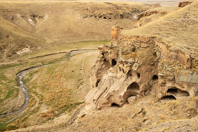
Ancient cave dwellings of Ani
Baron Max von Thielmann (1872) in his book ‘Journey in the Caucasus, Persia, and Turkey In Asia’ describes seeing Ani and its marvelous architecture that at “some parts are as fresh-looking as if they were only completed yesterday.” He further describes the sensation of being at the site as follows:
“On reaching a gentle ridge extending between two hills some 200 feet in height (near Kara-Kala in the Five Verst Map), a panorama disclosed itself to our gaze, which for wild and desolate grandeur is perhaps unparalleled. Before us lay extended a rocky plain about five miles in length, and at its further extremity was a mighty city, surrounded by walls with towers, churches and palaces – a noble pile, but devoid of animation.
The associations aroused by this scene were enhanced a thousand-fold by the tranquility and desolation which prevailed; for in days gone by the capital of a mighty empire had stood on this very spot in full glory and magnificence; and so intense was the impression occasioned by this solitude amongst ruins, that, even later on at Babylon and at Palmyra, I did not experience so acute a sensation.”
William of Rubruck in the account of his visit to Ani in 1255 states:
“On the feast of the Purifaction I was in a city called Ani. Its population is extremely strong: it contains a thousand Armenian churches…”
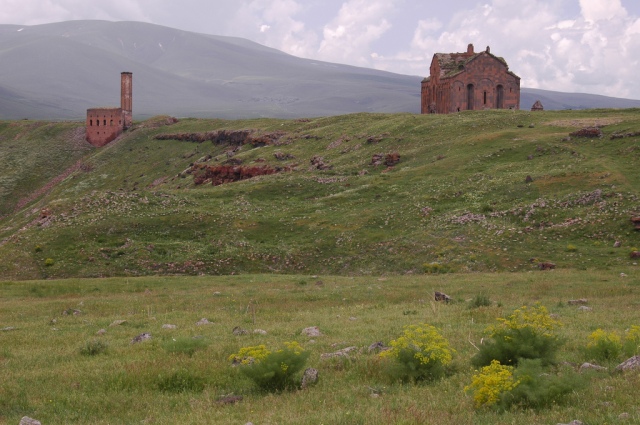
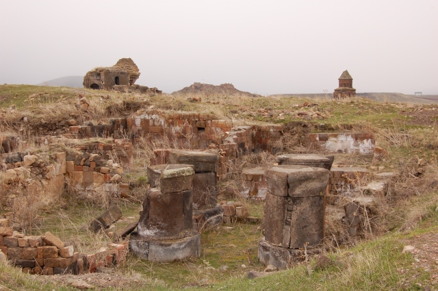
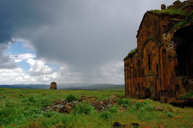
Bellow some more images of the abandoned ancient capital of Armenia:
Ani ruins – view toward Armenia
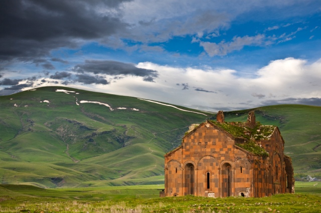
Church of St. Gregory built in 1001
Ruins with Church at Rear – Ani (Ancient Armenian Capital) – Near Kars – Turkey
Ani Church of St Gregory (1215)
Holy Apostles church of Ani


Church of St. Gregory built in 1001
Church of St. Gregory built in 1001
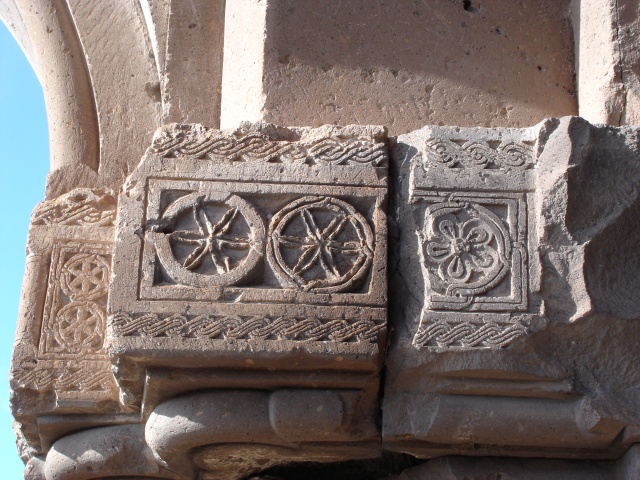
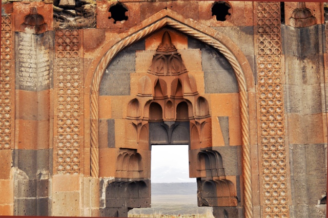
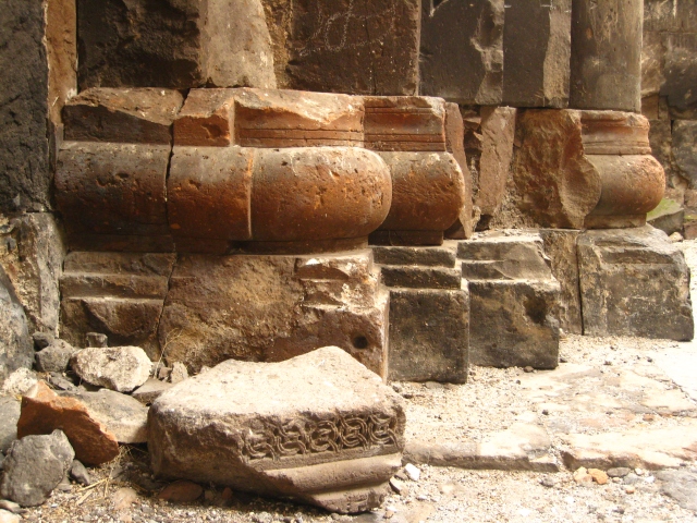
Ornamental stones of a ruined Armenian church in Ani
Sources:
http://armenianhouse.org/villari/caucasus/alexandropol-ani.html
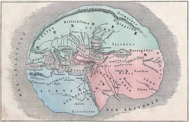
This is an interesting map, one of the earliest maps in the form of an animal (or a human). This map as it is quit creative. Armenia is situated at the brains of the Pegasus.

Title: Asia Secunda Pars Terrae in Forma Pegasi [Asia in the Form of Pegasus]
Map Maker: Heinrich Bunting
Date: Hannover / 1581
Description:
Unusual variant edition of Bunting’s map of Asia in the shape of the mythical winged horse Pegasus. The horse is drawn fairly realistically, with a good deal of imagination required to view the map. The head represents Asia Minor with the brains in Armenian Highlands. The wings portray Central Asia and Siberia. The Caspian Sea appears horizontally between the wings and the saddle. Persia is delineated on the horse blanket with the forelegs forming Arabia. The hind legs represent the Indian and Malay Peninsulas.
The map is among the earliest representations of a land mass in the form of an animal (or human).
Captain Jim Chankalian was promoted to captain in the U.S. Army for his service during the Spanish-American War in 1898, and later with great success and honors he participated in the Armenian liberation movement. Afterwards he served in the Democratic Liberal Party of America, AGBU and the Armenian Church, until his death on May 10, 1947.
Captain Jim Chankalian, Armenian hero of the Armenian liberation movement.
Born in Tigranakert as Bedros Chankalian, James (Jim) and his family emigrated to the United States. He graduated from an American high school and then entered the military academy to become an officer in the United States.
Being an experienced soldier of the U.S. Army, Chankalian also became a well-known figure in the Armenian community of New York. After retiring with the rank of captain, he was offered an important position in the company “Powers & Co.” and build a comfortable life for himself. In 1915, the Reformed party Gnchak, in collaboration with the Regional Committee of the Constitutional Democratic Party (Ramgavar) of the United States requested to send Jim Chankaliana with a special mission, first to the Caucasus, and then to Van, to fight for the Armenian liberation movement. Chankalian gladly accepted the offer, giving up his high position and a comfortable life in America. Taking with him a group of experienced volunteers who came from Western Armenia, he reached Van at the appointed time and was met by the heroic leader of Armenian self-defense forces, Armenak Egaryan.
After consultation with Egaryan, Chankalian put his extensive military experience in service of the heroic struggle of the Armenians of Van and became the adviser to Egaryan. As such he became instrumental in the formation of the Yerkrapah regiment (Defenders of the Motherland) and was successful in the accomplishment of his military mission.
In 1917 he returned to the U.S., but as soon as he learned about the plan of formation of the Armenian Legion in France, he decided to join. The legion was to go to Palestinian front to fight on the side of the Allies (France, England, Russia) against the German and Turkish troops. Chankalian who enjoyed unconditional respect and reverence of the American-Armenian community and the Armenian political parties, was appointed head of the detachment, consisting of US-Armenian volunteers. On July 9, 1917 Chankalian along with the volunteers, under his leadership, boarded a French ship and headed to Marseille. From there he went to Port Said and joined the Legion. They were transported to Cyprus and met with the rest of the volunteers of the French Foreign Legion.
By order of General Allenby, commander of the united forces of the Allied Powers in the Middle Eastern front, on September 14, 1918 the Armenian volunteers were transported to Palestine, where five days later, they went on the attack against German and Turkish forces in Arar. With minimal losses they have achieved a glorious victory in the Battle of the Arar.
As the World War I ended in November 1918, the Armenian volunteers were transferred to the Palestinian front in Beirut. From there, the British ships took them in groups, through Alexandretta (Iskenderun) to the mountains and plains of Cilicia. Legionnaires were welcomed in Adana with the Armenian tricolor flags. Turks were already demoralized an the Armenian Legion was about to take all of Cilicia under their control. Implementation of the plan to establish an autonomous and independent Armenian Cilicia was undertaken under the guidance of Mihran Damadyan. In order to bring this plan to fruition, it was necessary to gather a strong fighting force, which was about to become a reality, with such battle-tested heroes as Chankalian, Andranik, Egaryan, Esai Yagubyan etc. However, the Allied Powers had other intentions. They have prevented the arrival of Andranik, Egaryana and others in Cilicia, ending the prospects of Armenian success in Cilicia.
Disappointed with the vanishing dream to create an independent Cilicia, Chankalian returned to the United States, with his achievements recorded in the history of the Armenian liberation struggle. Later, as one of the leading figures of the Democratic Liberal Party of America, Chankalian organized fundraising efforts in support of the first Republic of Armenia.
Chankalian continued his activities for the benefit of the motherland. He became the driving force behind the formation of the American-Armenian National Council and served as its president. He also became the first president of the Central Committee of the Armenian General Benevolent Union (AGBU) and devoted his time to the service of the Armenian Church. This great patriot, endowed with exceptional military skill, died in New York in 1947 at an advanced age, leaving behind a great legacy of unforgettable service for his people.
source: Armeniangc.com
Grave of Captain Jim Chankalian
Rare Armenian coin Kiurike I the Kouropalates (979-989 AD.)
This is a very rare Armenian coin as it is the earliest example of coinage inscribed with Armenian writing. This coin is struck during reign of Kiurike I (979-989 AD.) ruler of Armenian kingdom of Lori. On the front side we see facing bust of Christ with cross nimbate, wearing himation. I[SOU]S and K[RISDO]S is inscribed in Armenian letters. On the reverse the Armenian inscription in five lines reads: “May God aid Kiurike the Kouropalates”. The title Kouropalates was bestowed upon the most prominent local dynasty on the fringes of the Byzantine empire, the granting of which signified favor and recognition by the Byzantine court.
The importance of this unique issue of Armenian medieval coinage was eloquently summarized by David M. Lang in ANS Museum Notes VI in 1954: “…this is the earliest monetary issue to bear an inscription in Armenia, as well as being the only such type struck within Great Armenia in Transcaucasia before the transference of the kingdom to Little Armenia in Cilicia.”
This coin is recently sold for $16.000!
Sources:
https://www.numisbids.com/n.php?p=lot&sid=615&lot=80
http://www.ngccoin.com/news/viewarticle.aspx?NewsletterNewsArticleID=603
World map according to Claudius Ptolemy, an astronomer, geographer, mathematician and astrologer who lived from 90 – 168 AD. This map is part of Cosmography compiled in its entirety in 1467 in Florence, Italy and is written in Latin. Retrieved from Polona Digital Library.
World map according to Ptolemy (2st. c. AD)
ZOOMED: Greater Armenia according to Ptolemy
Ruins of the Erebuni fortress
After the unification of the Nairi states by Arame (858 BC–844 BC), historic Armenia known to Assyrians as Urartu became one of the mighty states of the Ancient East. Among the earliest and biggest towns of historic Armenia there was Erebuni situated on Arin-berd hill (the south-eastern outskirt of what is now Yerevan), a major administrative and economic center of the northern part of the country. According to the Khorkhor cuneiform record and two other identical records found in the citadel, Erebuni was built by Argishti I in 782 B. C. (this date is considered that of the foundation of Yerevan). In honour of founding the city, a painted figurine of an armed warrior was made, with a cuneiform inscription on a bronze pedestal. This confirms the signifcance of Erebuni is an important military stronghold of the country. The name Yerevan itself is derived from Erebuni.
The fortress of Erebuni was skillfully build in the tradition of the kingdom of Van. Town neighbourhoods were situated at the foot of a nearly 65-m high hill crowned with the citadel which was the architectural dominant of the surrounding locality. The citadel commanded a full view of the Ararat plain with its settlements and the main roads leading to Erebuni. The configuration of the hill top determined the triangular shape of the citadel’s plan.
Another element of variety was a six-column portico which stood left of the road and accentuated the entrance to the citadel. The portico was painted with colorful frescoes, and the stairway which led up to it was flanked with bronze figures of winged oxen with human heads. The citadel comprised palaces, houses of worship and service premises situated at various levels, depending on the hill surface, and interconnected by stairways. The main entrance way led to the central yard which was reserved for all sorts of ceremonies and for the parades of the personal guards of Argishti I and of the fortress’ garrison. One of the frescoes showed a large scene of hunting, with a nobleman driving in a chariot accompanied by leopards.
In the south-western part of the yard there was the temple of god Khaldi – an oblong large hall with an auxiliary room and a staircase leading to the roof of the tower, and an open 12-column portico, with columns in double rows, where the garrison was probably drawn up. The walls are lined with benches for notables and, at the left end wall, there is an altar for sacrifices. The temple was richly ornamented. Its walls were painted with colourful representations of human figures and gods, with geometrical and floral ornaments. Of special interest is the representation of god Khaldi standing on a lion, with a warder in his left hand and with a horned tiara on his head; it is similar to the bas-relief representation of god Teisheba in Adildzhevaz and many others known in the art of Urartu.
An opening over the credence altar served to let in daylight and draw the altar smoke out. There was another credence altar which stood outside the temple, in the middle of the peristylar yard. The interior and exterior walls of the building were painted sky-blue. Next to the temple there were service premises including two wine stores with enormous (up to 600 litres) jars for wine used in sacrifice offering ceremonies.
Cuineform inscriptions, cut not only on the stone walls but also on the column bases, say that shortly upon being completed, the palace was expanded. Argishti had new premises, organically connected with the fortress layout, added to its south-eastern side.
Successive Urartian kings made Erebuni their place of residence during their military campaigns against northern invaders and continued construction work to build up the fortress defences. Kings Sarduri II and Rusa I also utilized Erebuni as a staging site for new campaigns of conquest directed towards the north. In the early sixth century the Urartian state became a vessel of the Achaemenian Empire. The strategic position that Erebuni occupied did not diminish, however, becoming an important center of the satrapy of Armenia. Despite numerous invasions by successive foreign powers, the city was never truly abandoned and was continually inhabited over the following centuries, eventually branching out to become the city of Yerevan.
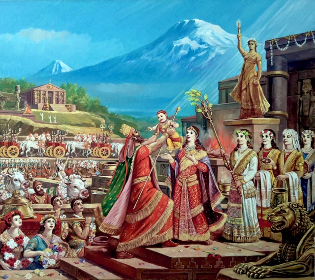
King Aram with His Child Ara the Handsome, by Rubik Kocharian, 2014
Armenia was well known to classical Greek and Roman writers who on occasion made personal journeys to Armenia describing some of its countryside, villages and cities. Many of which are today only remembered through their records. Pliny the Elder for example recounts a few in his work “The Natural History” (6.10):
“The more famous towns in Lesser Armenia are Cæsarea, Aza, and Nicopolis; in the Greater Arsamosata, which lies near the Euphrates, Carcathiocerta upon the Tigris, Tigranocerta which stands on an elevated site, and, on a plain adjoining the river Araxes, Artaxata… Claudius Cæsar makes the length (of the country Armenia), from Dascusa to the borders of the Caspian Sea, thirteen hundred miles, and the breadth, from Tigranocerta to Iberia, half that distance. It is a well-known fact, that this country is divided into prefectures, called “Strategies,” some of which singly formed a kingdom in former times; they are one hundred and twenty in number, with barbarous and uncouth names.”
Ptolemy gives a list of Armenian towns, some of which are not recorded in other sources, and their site remains unknown. The towns which are best known in connection with the writers of Greece and Rome are: Artaxata or Artaxiasata; Tigranocerta; Theodosiopolis; Carcathiocerta; Armosata; Artageira; Naxuana; Morunida; Buana; Bizabda and Amida.
Let us examine some of these cities in more detail:
Armenian Kingdom of Sophene Arsames II ca. 230BC
Arsamosata (Արշամշատ, Arshamshat) was a city in Armenian Sophene near the Euphrates. It was founded by King Arsames I of the Orontid Dynasty in the 3rd century BC. Polybius provides our earliest extant evidence for Arsamosata in western Armenia (Sophene). According to him Antiochos III encamped before Armosata, which was located near the “Fair Plain,” between the Euphrates and the Tigris. Polybius also says that Xerxes was the king of the city. This Xerxes (Armenian: Shawarsh) is the son of Arsames, who founded Arsamosata. Pliny said it was one of the important cities of Greater Armenia, and Tacitus described it as a fortress. Ptolomy said it was located in the region between the Euphrates and the Tigris. In the Middle Ages it was called Ashmushat. The city has been identified with the modern Kharput (Elazığ). T. A. Sinclair has located Arsamosata at the site of Haraba near Kharput. Much of that site now lies submerged under the waters due to the construction of the Keban Dam.
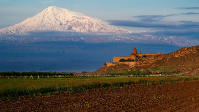
Location of anicent Artashat, Armenia. Khor Virap and Ararat-Landscape
Founded by King Artashes I in 176 BC, Artashat served as the capital of the Kingdom of Armenia from 185 BC until 120 AD, and was known as the “Vostan Hayots” or “court” or “seal of the Armenians.” The story of the foundation is given by the Armenian historian Movses Khorenatsi of the fifth century:
“Artashes traveled to the location of the confluence of the Yeraskh and Metsamor [rivers] and taking a liking to the position of the hills [adjacent to Mount Ararat], he chose it as the location of his new city, naming it after himself.”
According to the accounts given by Greek historians Plutarch and Strabo, Artashat is said to have been chosen on the advice of the Carthaginian general Hannibal. However, modern historians argue that there is no direct evidence to support the above mentioned passage. Some sources have also indicated that Artashes built his city upon the remains of an old Araratian settlement.
Strabo and Plutarch describe Artashat as a large and beautiful city and the royal residence (basileion) of the country. Plutarch also mentions that it was the royal residence of Tigranes. A focal point of sophisticated culture, Armenia’s first theater was built here. Movses Khorenatsi mentions numerous pagan statues of the gods and goddesses of Anahit, Artemis and Tir were brought from the religious center of Bagaran and other regions to the city.
Artashes also built a citadel (which was later named Khor Virap and gained prominence as the location where Gregory the Illuminator was to be imprisoned by Trdat the Great) and added other fortifications, including a moat. The city’s strategic position in Araks valley on the silk road, soon made Artashat a center of bustling economic activity and thriving international trade, linking Persia and Mesopotamia with the Caucasus and Asia Minor. Its economic wealth can be gauged in the numerous bathhouses, markets, workshops administrative buildings that sprang up during the reign of Artashes I. The city had its own treasury and customs. The amphitheater of Artashat was built during the reign of king Artavazd II (55-34 BC). The remains of the huge walls surrounding the city built by King Artashes I could be found in the area.
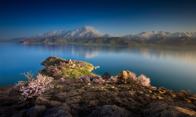
Lake Van
A rather mysterious and forgotten city in ancient Armenia. Ptolomy twice mentions an Artemita in Armenia (5.13.21, 8.19.13). These are the only extant ancient attestations for Artemita. M. L. Chaumont has suggested it was located on the southern shores of Lake Van at the site of the town of Edremit. Horatio Southgate (1840) in his book “Narrative of a Tour Through Armenia, Kurdistan, Persia and Mesopotamia” also identifies Artemita with the village Erdremit:
“The name of this village (Erdremid) seems to have escaped entirely the notice of geographers, probably from the fact, that the few travelers who have passed this way did not stop here, but ended their day’s journey in Van. It was only the accident of sickness which induced me to make it my resting-place for a night. I think there can be little doubt that is the site of the ancient city of Artemita.”
Today there is a village in the Armavir Province of Armenia known as Artamet.
Tigris river near Diyarbakir
Another fairly unknown ancient Armenian city was recorded by a Greek author Stephanos. Stephanos is our sole extant source for an Epiphaneia on the Tigris. He adds that originally it had been called “Arkesikerta” and that it had been founded by Arkesios. A number of sources mention that Antiochos IV Epiphanes conducted a campaign against the Armenian king Artaxias probably in 165 B.C. We can therefore safely assume that the settlement was subsequently renamed by Antiochos IV.
M. L. Chaumont suggested one of two possible locations for Epiphaneia: Egil or Diyarbakir (modern Amida), both in southeastern Turkey.
Ancient ruins at Eğil near the river Tigris
Carcathiocerta was a city in Armenian Sophene near the Tigris, identified with the modern city of Eğil. It was the first capital of Sophene until Arsames I founded the new capital Arshamshat around 230 BCE.
Not much has been recorded about the city but Strabo in his Geography, calls it “The royal city of Sophene”.
Tigranakert of Artsakh
Tigranocerta was the capital of the Armenian Kingdom. It bore the name of Tigranes the Great, who founded the city in the first century BC. The name of the city means “made by Tigran”, and was possibly located near present-day Silvan or nearby Arzan (Arzn, in the Armenian province of Arzanene or Aghdznik), east of Diyarbakır modern day Turkey. It was one of four cities in historic Armenia named Tigranakert. The others were located in Nakhichevan, Artsakh and Utik.
The city’s markets were filled with traders and merchants doing business from all over the ancient world. Tigranocerta quickly became a very important commercial, as well as cultural center of the Near East. The magnificent theater that was established by the Emperor, of which he was an avid devotee, conducted dramas and comedies mostly played by Greek as well as Armenian actors. Plutarch wrote that Tigranocerta was “a rich and beautiful city where every common man and every man of rank studied to adorn it.” Tigranes had divided Greater Armenia – the nucleus of the Empire – into four major strategic regions or viceroyalties.
A Roman force under Lucius Lucullus besieged the city in the summer of 69 B.C. but was unable to swiftly overrun it. Tigranocerta was still an unfinished city when Lucullus laid siege to it in the late summer of 69. The city was heavily fortified and according to the Greek historian Appian, had thick and towering walls that stood 25 meters high, providing a formidable defense against a prolonged siege. The Roman siege engines that were employed at Tigranocerta were effectively repelled by the defenders by the use of naphtha, making Tigranocerta, according to one scholar, the site of “perhaps the world’s first use of chemical warfare.” After a lengthy siege the gates to Tigranocerta were sabotaged and opened by the foreign inhabitants of the city. Lucullus entered the city and sacked Tigranocerta. After the plunder, which included the destruction of statues and temples, the city was set ablaze. An abundant quantity of gold and silver was carried off to Rome as war booty. Lucullus took most of the gold and silver from the melted-down statues, pots, cups and other valuable metals and precious stones. The newly established theater building was also destroyed in the fire. Nonetheless Tigranes managed to escape north into Armenian Highlands.
In the summer of 68 BC Lucullus again marched against Tigranes the Great and crossed the Anti-Taurus range heading for the old Armenian capital Artaxata. Once again Tigranes was provoked to attack and in a major battle at the Arsanias River Lucullus was heavily defeated by the Armenian army. Soon he left this campaign and when winter came on early in the Armenian Highland, his troops mutinied, refusing to go further, and he was forced to withdraw southwards back into Arzenene. From there he proceeded back down through Gordyene into old Assyria. During the winter of 68-67 B.C. at Nisibis, his authority over his army was more seriously undermined as mutiny spread in the legions with the troops refusing to obey Lucullus’ commands. After these defeats Lucullus was thoroughly discredited in the eyes of his soldiers, as well as the senate.
The Roman senate sent Pompey to succeed Lucullus in the eastern campaign. Tigranocerta was retaken briefly by Rome, but given back to Tigranes as a means for consolidating peace. Pompey was inclined to make peace with the 75 year old King and Tigranes continued to rule Armenia as an ally of Rome until his death. As Cicero amply describes in his work For Sestius:
“Tigranes—who was himself an enemy of the Roman people, and who received our most active enemy in his territories, who struggled against us, who fought pitched battles with us, and who compelled us to combat almost for our very existence and supremacy—is a king to this day, and has obtained by his entreaties the name of a friend and ally, which he had previously forfeited by his hostile and warlike conduct.”
During the Ottoman period, Armenians referred to the city of Diyarbekir as Dikranagerd (Western Armenian pronunciation of Tigranakert).
View of modern Erzurum, East Turkey.
The city of Erzurum was founded by the Armenian royal dynasty. In ancient times, Erzurum existed under the Armenian name of Karin. During the reigns of the Artaxiad and Arsacid kings of Armenia, Karin served as the capital of the eponymous canton of Karin, mentioned in Strabo’s Geography (12.3) as a large district named Carana. After the partition of Armenia between the Eastern Roman Empire and Sassanid Persia in 387 AD, the city passed into the hands of the Romans. They renamed it to Theodosiopolis, in honour of the Emperor Theodosius the Younger in A. D. 416. It was for a long time subject to the Byzantine emperors, who considered it the most important fortress of Armenia. As the chief military stronghold along the eastern border of the empire, Theodosiopolis held a highly important strategic location and was fiercely contested in wars between the Byzantines and Persians. About the middle of the 11th century it received the name of Arze-el-Rum, contracted into Arzrum or Erzrum. It owed its name to the circumstance, that when the city of Arzek was taken by the Seljuk Turks, A. D. 1049, its Armenian, Syrian, and other Christian inhabitants moved to Theodosiopolis, and gave it the name of their former abode. Which from its long subjection to the Romans had received the epithet of Rúm.
Sources:
The Russian artist Ilya Nikolaevich Zankovsky has created a great amount of paintings with Ararat during his travels in the Caucasus. Here are some of them.
Ilya Nikolaevich Zankovsky, view of mount Ararat
Ilya Nikolaevich Zankovsky, view of mount Ararat
Ilya Nikolaevich Zankovsky, karavan at the foot of mount Ararat
Ilya Nikolaevich Zankovsky, karavan at the foot of mount Ararat
Sunset to the west of Mount Ararat by Ilya Nikolaevich Zankovsky
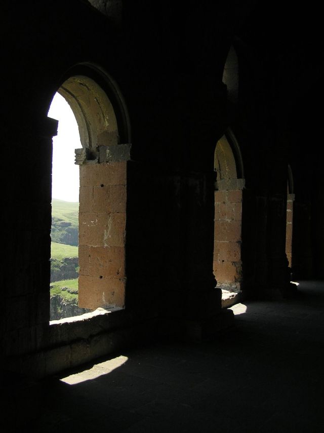
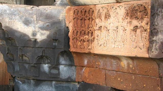
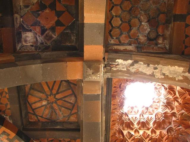
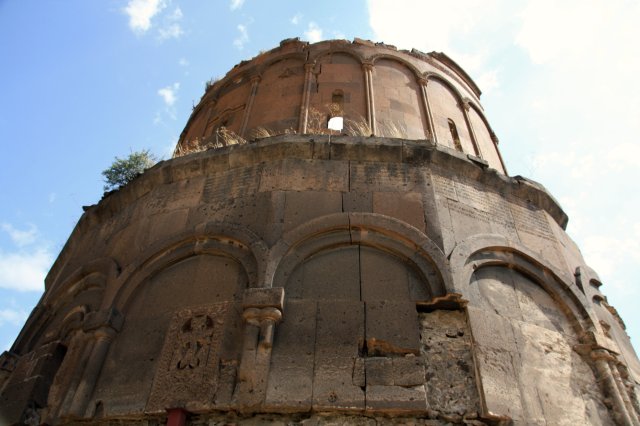
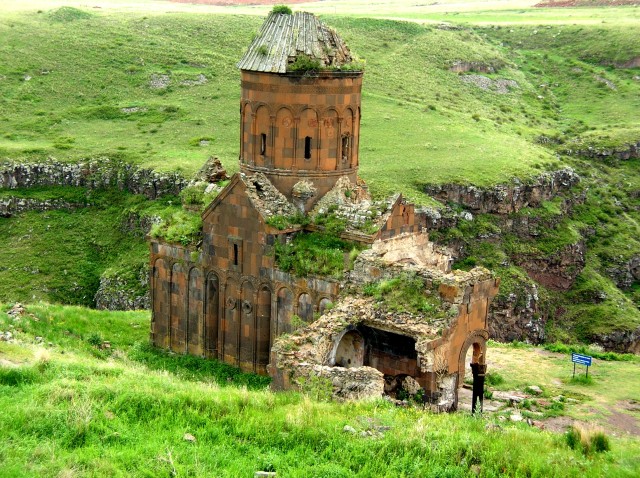
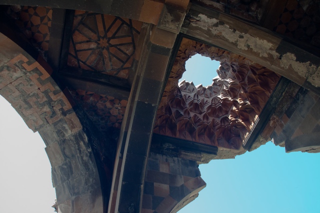
Noravank Monastery 13th century – Armenia
Noravank (meaning “New Monastery”) is a 13th-century Armenian monastery, located 122km from Yerevan in a narrow gorge made by the Amaghu river. The gorge is known for its tall, sheer, brick-red cliffs surrounding the monastery. Noravank was founded in 1205 by Bishop Hovhannes, a former abbot of Vahanavank and became the residence of the Orbelian princes. The architect Siranes and the miniature painter and sculptor Momik worked here in the latter part of the thirteenth and early fourteenth century. In the 13th and 14th centuries it became a major religious and cultural center of Armenia.
The grandest structure is Surb Astvatsatsin (Holy Mother of God), also called Burtelashen (Burtel’s construction) in the honour of Prince Burtel Orbelian, its financier. Surb Astvatsatsin was completed in 1339, a masterpiece of the talented sculptor and miniaturist Momik, who designed it, and was also his last work. The ground floor contains elaborate tombs of Orbelian Princes and their family.
The complex has several surviving cross-stone (khachkars). The most intricate of them all is a 1308 khachkar by Momik. Standing out against the carved background are a large cross over a shield-shaped rosette and salient eight-pointed stars vertically arranged on its sides. The top of the khachkar shows a Deesis scene framed in cinquefoil arches symbolizing a pergola as suggested by the background ornament of flowers, fruit and vine leaves.
The complex was renovated in the late 1990s and early 2000s under the sponsorship of Mr. & Mrs. Hadjetian.
Shavarsh Karapetyan
17 times world champion finswimmer, 13 times European champion and 7 times Soviet champion. Eleven-time World Record-breaker. This remarkable man has a fascinating history of saving lives and facing his own mortality.
When he was 15, he got into a fight with a group of hooligans who beat him, tied a heavy stone to his neck , thrown him into a lake and left. He started moving his body under water and managed to rip the ropes off his hands, after which he released himself from the stone on his neck and swam to the surface. In an interview he said:
“If the stone was slightly heavier, I would not be able to get out of the water”.
This experience encouraged him to take swimming lessons. He was so talented that he started to compete on a professional level. Teaching himself without a trainer, he became a champion of Armenia at the age of 17. He began to beat his popular peers but was cut from the national team by envious trainers. It was a hard time for the young swimmer, but he did not abandoned his calling. He switched to finswimming and within 6 months became the “master of sports of the Soviet Union”, in 8 months he became “master of international class”, within 12 months he became the champion of the Soviet Union and within 14 months he became the European champion by breaking the World record.
Shavarsh Karapetyan with medals
During his competitions in Kiev he nearly died again when a competent had opened his oxygen tank and let a good amount of oxygen out to make him lose the competition. Nevertheless he continued the swim, losing oxygen he had to hold his breath for 75 meters. Feeling his life slipping he lost his consciousness but won the event and was immediately hospitalized. He only heard of his victory in the hospital.
His courage was again tested in 1974 when Shavarsh was riding the morning bus to the swimming pool. During the ride, the driver lost control of the bus on the mountainous passage and was about to drive strait off the cliff. Shavarsh quickly jumped into the driver’s seat and was able to steer the bus away from the impending plunge, only half a meter from the side of the cliff. On that faithful day he saved 30 people including himself.
Two years later faith struck again. One cold morning on September 16th, 1976 he was doing his usual run along the dam in Yerevan (Armenia), when a large trolleybus carrying 92 passengers lost control and flew off the road into the freezing water. During the impact, most of the passengers fell unconscious – the bus sank approximately 10 meters deep. Without a second of hesitation, Shavarsh leaped into the freezing water to rescue people. Diving to the depth of 10 meters, Shavarsh used his feet to break the back window of the trolleybus. One by one, he saved 20 peoples’ lives (he actually pulled out more then 20, but not everyone made it). He spent nearly 20 minutes in the frigid water and accomplished 30 dives down to the wreck of the bus. His brother – Kamo Karapetyan – is also a swimmer, and took care of the injured people as Shavarsh brought them up to the surface.
After his 30th dive, Shavarsh lost consciousness. This courageous act has cost him dearly; he incurred heavy 2-sided pneumonia and blood contamination from the polluted water. Doctors were unsure if Shavarsh would ever recover. His life was hanging on by a thread while he stayed unconscious for 46 days. He finally recovered, but his professional career was at an end. Today’s experts agree that no one but Shavarsh could have done what he has done. Bystanders who watched Shavarsh bring people up to the surface said that his feet glass shards and his back cut on many places. When later asked, what was the most horrifying part of this, Shavarsh replied by saying:
“I knew that I could only save so many lives, I was afraid to make a mistake. It was so dark down there that I could barely see anything. One of my dives, I accidentally grabbed a seat instead of a passenger… I could have saved a life instead. That seat still haunts me in my nightmares.”
Trolleybus crash, pulling out.
He suffered from inflammation of longs, blood poisoning and extreme nervous exhaustion. Nevertheless, he went on to compete for the last time and had broken the world record for the 11th time. Physical and Psychological trauma had eventually taken a toll on him and he had to retire from the sport. Afterwards he developed a strong aversion for water and went to work in an electronics factory. He didn’t want to go near the water again he said.
Due to Soviet politics Karapetyan’s achievement was not immediately recognized. His name became a household name in the USSR on October 12, 1982, when Komsomolskaya Pravda published an article on his feat, entitled “The Underwater Battle of the Champion”. This publication revealed that he was the rescuer; and he received over 75,000 letters.
When asked about his encounters with faith he answered:
“It is something from above that is guiding humanity, you know, something is guiding us. Because at that moment I had to be at the world championships in Hannover. But for some reason my Visa was not ready, because I often won they didn’t grant me one for the competition on time, so I left bitter and went training when the crash happened.”
Soviet Armenian Sports hall
On February 19, 1985, Shavarsh just happened to be near a burning building (the famous Soviet Armenian sports hall), that had people trapped inside. He rushed in and started pulling people out without a second thought. Once again, he was badly hurt. He had inhaled toxic fumes and lost his consciousness because of it. Everyone thought he had passed, but a local cab driver felt a weak pulls and rushed him to the hospital. He spent a long time in the hospital recuperating from severe burns and smoke inhalation.
Karapetyan was later awarded a medal “For The Rescue of the Drowning” and the Order of the Badge of Honor. He also received a UNESCO “Fair Play” award for his heroism. A main belt asteroid, 3027 Shavarsh, discovered by Nikolai Chernykh, was named after him.
Recently Karapetyan was granted the honor to take part in the 2014 Winter Olympics torch relay for the second stage of the race. He was passed the torch in Moscow and had to carry it towards Krasnogorsk. During his run in Moscow the Olympic fire suddenly went out. It was relit, but this led to much ridicule from western media outlets, eager to slam the Olympics held in Russia. On the next day he was allowed to carry the torch for a second time, making him the only person in Olympic history who carried the Olympic torch twice on the same event.
Shavarash Karapetyan, during his 2 runs runs after the fire went out on the first.
Since 1993, Shavarsh has been living a simple life. He owns and operates a shoe shop in Moscow called “Second Breath”. He regularly visits Armenia and the Nagorno-Karabakh Republic. He stated in a recent interview:
“I was carrying the torch for Russia and for Armenia.”
This is the fascinating true story of a real life superhero: Shavarsh Karapetyan remember his name!


")


")